Pak Imtehan
Geopolitics
What is Geopolitics? A Beginner’s Guide to How Geography Shapes Power
To understand why countries behave the way they do, you must first look at a map. You might assume that leaders make decisions based solely on ideology, personal whims, or economic theories. While those factors matter, they are secondary to the physical reality of the earth itself. Geopolitics is the study of how a country's location and physical environment dictate its choices and its power. It is the most permanent factor in international relations.
Leaders come and go. Governments rise and fall. Ideas change. But the mountains of the Himalayas remain where they are, the English Channel still separates Britain from the European mainland, and the vast plains of Northern Europe continue to offer a flat path for invading armies. If you imagine a country as a house on a street, you can see how its environment defines its life. A house at the end of a quiet cul-de-sac has a different security profile than a house located on a busy corner with four different entry points. Geopolitics is simply the art of managing that "house" based on where it sits on the global block.
The Physical Constraints: Barriers and Highways
Geography is not fair. It does not distribute advantages equally. Some nations are blessed with natural defenses, while others are doomed by their lack of them. The physical terrain of a nation serves as the primary driver of its national security strategy.
Mountains and Rivers
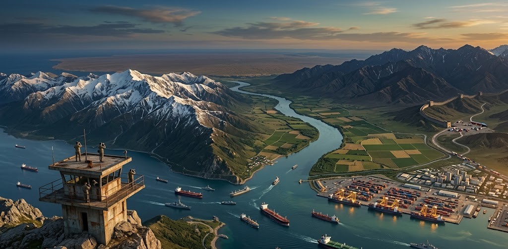
Mountains are the most effective barriers in history. They are expensive to cross, difficult to move armies over, and they create natural borders. Consider the border between India and China. Despite being the two most populous nations on earth, they have never fought a full-scale, prolonged war for total conquest. The reason is the Himalayas. No army can effectively supply millions of troops over the highest peaks on earth.
Conversely, rivers can act as either barriers or highways. In the United States, the Mississippi River system provided a massive internal highway that allowed for the cheap transport of goods, which helped the young nation grow into an economic powerhouse. In contrast, many rivers in Africa are interrupted by massive waterfalls or plateaus, which historically made it harder to move goods from the interior to the coast.
The Heartland and the Rimland
Early thinkers in this field tried to boil the world’s map down to a single formula. Halford Mackinder, a British geographer, proposed the Heartland Theory. He argued that the interior of Eurasia (modern-day Russia and Central Asia) was the pivot of world history. Because this land was inaccessible to sea power, whoever controlled it could eventually dominate the world.
Later, Nicholas Spykman proposed the Rimland Theory. He argued that the real power lay not in the interior, but in the coastal fringes of Eurasia. These areas, like Western Europe, the Middle East, and East Asia, are where the people, the wealth, and the trade routes are located. If a single power controlled the Rimland, they could contain the Heartland and dominate the globe. This thinking defined much of the Cold War, as the United States worked to prevent the Soviet Union from expanding its influence into these coastal regions.
The Importance of Resources: The Fuel of Foreign Policy
If geography provides the stage, resources provide the script. A country might have a great location, but if it cannot feed its people or power its industry, it is vulnerable. Access to oil, gas, minerals, and arable land forces countries into specific alliances and conflicts.
Arable land is the most basic requirement for power. A nation that cannot feed itself is a nation that can be held hostage by its neighbors. This is why countries like Egypt are so sensitive about any dam construction on the Nile River in Ethiopia. The Nile is not just a river; it is a lifeline. Without it, the desert swallows the nation’s food supply.
Natural resources like oil and gas create a different kind of pressure. They provide wealth, but they also create a target. The Middle East is a focal point of global politics because it sits on a massive percentage of the world’s proven oil reserves. Because the modern world runs on hydrocarbons, every major power has a vested interest in the stability (or instability) of that region. A country’s foreign policy is often just a reflection of its energy needs. Japan, for example, has almost no domestic energy resources. This reality has forced it to maintain a massive navy and build deep ties with energy producers thousands of miles away to ensure its survival.
Choke Points and Trade Routes: The World’s Narrow Doors
Most global trade moves by sea. It is the cheapest way to move heavy goods. However, the oceans are not a wide-open highway. They are constricted by choke points, narrow passages that can be easily blocked or controlled.
The Suez Canal and the Strait of Hormuz
The Suez Canal connects the Mediterranean to the Red Sea. If it is closed, ships traveling from Asia to Europe must go all the way around the tip of Africa, adding weeks to the journey and billions to the cost.
The Strait of Hormuz is even more sensitive. It is the only way out of the Persian Gulf. At its narrowest point, the shipping lanes are only two miles wide. About a third of the world’s sea-borne oil passes through this tiny gap. If a country like Iran were to block this strait, the global economy would face an immediate and catastrophic energy crisis. This physical reality forces the United States and other powers to keep a permanent military presence in the region.
The Malacca Strait
Between Malaysia and Indonesia sits the Malacca Strait. It is the primary gateway for trade between the Indian and Pacific Oceans. For China, this is a major vulnerability. Most of China’s oil imports pass through this strait. If a hostile navy were to block it, China’s economy would grind to a halt within months. This "Malacca Dilemma" explains why China is so aggressive in the South China Sea; it is trying to secure the waters leading to its front door.
Case Study: Russia’s Search for Warm Water
Russia is the largest country on earth, but its geography is a prison. It is a land-locked power in disguise. Most of its coastline is in the Arctic, which is frozen for much of the year. To be a global power, a nation needs a navy that can operate year-round. This is why Russia has spent centuries trying to secure a warm-water port.
In the north, the port of St. Petersburg is restricted by the narrow exits of the Baltic Sea, which are controlled by NATO members. In the east, Vladivostok is limited by the Sea of Japan. This leaves the Black Sea. For Russia, the port of Sevastopol in Crimea is a vital necessity. Without it, Russia cannot project power into the Mediterranean or the Atlantic. The 2014 annexation of Crimea and the subsequent war in Ukraine can be understood, at least in part, as a desperate attempt by Russia to keep its only reliable door to the world open.
Case Study: China’s Belt and Road Initiative
China faces a different problem. It is surrounded by rivals and natural barriers. To the north is the Gobi Desert and the frozen wastes of Siberia. To the west are the Himalayas. To the east and south is the "First Island Chain," a string of islands from Japan to the Philippines that are mostly allied with the United States.
To break out of this encirclement, China launched the Belt and Road Initiative. This is a massive infrastructure project designed to build new "highways" across the land and sea. By building railroads through Central Asia and ports in Pakistan and Sri Lanka, China is trying to create new trade routes that the US Navy cannot easily block. It is an attempt to rewrite the map of Eurasia to favor Beijing.
Case Study: The United States' Oceanic Isolation
The United States is arguably the most geographically blessed nation in history. It has the Atlantic Ocean to the east and the Pacific Ocean to the west. This makes it almost impossible for a foreign power to invade. It has friendly, weaker neighbors to the north and south.
Because the US does not have to worry about an invading army crossing its borders, it has been free to focus its energy outward. It uses the oceans as highways to reach every other market on earth while using those same oceans as a moat to keep its enemies at a distance. The dominance of the US Navy is the direct result of this geography. If you don't have to defend your own backyard, you can build a fleet that patrols everyone else’s.
Technology vs. Geography: Has the Internet Changed Everything?
Some people argue that in the age of the internet, satellites, and long-range missiles, geography no longer matters. They claim that we live in a "flat" world where distance is irrelevant. This is a mistake.
While technology can bridge distances, it cannot remove the physical constraints of the earth. You can send an email in a millisecond, but you cannot send 100,000 tons of iron ore through a fiber-optic cable. The physical world still requires physical infrastructure. Even the internet relies on geography; almost all trans-continental data travels through undersea cables that are laid along specific paths on the ocean floor. These cables have landing points that must be protected, and they are just as vulnerable to sabotage as a pipeline or a bridge.
Air travel has shortened the time it takes for people to move, but it is too expensive for the vast majority of global cargo. For as long as we live in physical bodies that require food, heat, and manufactured goods, we will be tied to the geography that provides them.
The Permanence of the Map
Geography is the one thing a leader cannot change. You can change your country’s tax code, its religion, or its political system, but you cannot move your country five hundred miles to the left.
Geopolitics teaches us that the behavior of nations is often a forced response to their environment. When you see a country acting aggressively, look at its borders. Is it a flat plain with no defense? When you see a country building a massive navy, look at its coastline. Is it dependent on sea trade?
Understanding the map is the first step to understanding the world. Geography does not determine every event, but it sets the boundaries of what is possible. It is the foundation upon which all of history is built. As long as the mountains stand and the seas remain wide, geography will continue to be the most powerful force in the shaping of our world.
Comments (0)
No comments yet. Be the first to comment!